Heading out on the water, whether for a calm kayak trip on a lake, an exciting day of fishing along the coast, or a week-long sailing trip, requires more than just enthusiasm. I’ve learned that careful planning is the foundation of every successful adventure. In the past, we relied on paper charts, a compass, and a weather report on the radio. Today, technology has given us an arsenal of digital tools that can transform our planning, increase our safety, and deepen our experience. For 2025, these tools have become more sophisticated and essential than ever, and knowing which ones to trust can be the difference between a memorable day and one you would rather forget.
Key Planning Tools for Your 2025 Adventures
To get the most out of your time on the water, having the right set of digital tools is no longer a luxury but a core part of preparation. From navigating remote waterways to staying ahead of unpredictable weather, these platforms are designed to minimize risks and maximize enjoyment. Here’s a breakdown of the essential apps and platforms I recommend for any water-based activity.
Essential Navigation and Mapping
The cornerstone of any trip planning is a reliable map. Digital mapping platforms have revolutionized how we navigate unfamiliar waters. Applications like Gaia GPS are known for their detailed maps and advanced route-planning features, making them invaluable for all types of outdoor activities, including those on water. I often use it to plan routes along complex coastlines or through lake systems, marking points of interest like campsites or ideal launch points for paddling. While the free version is quite capable, a premium subscription unlocks advanced features like offline map layers and detailed weather overlays, which I find to be a worthwhile investment for serious adventurers. The ability to download maps for offline use is a critical safety feature. I cannot count the number of times I have found myself in areas where cell service is a distant dream, and having access to detailed topographic maps on my phone has been invaluable. Avenza Maps is another robust alternative that operates on a similar principle, allowing you to download georeferenced maps for reliable offline navigation, ensuring you are never without a guide.
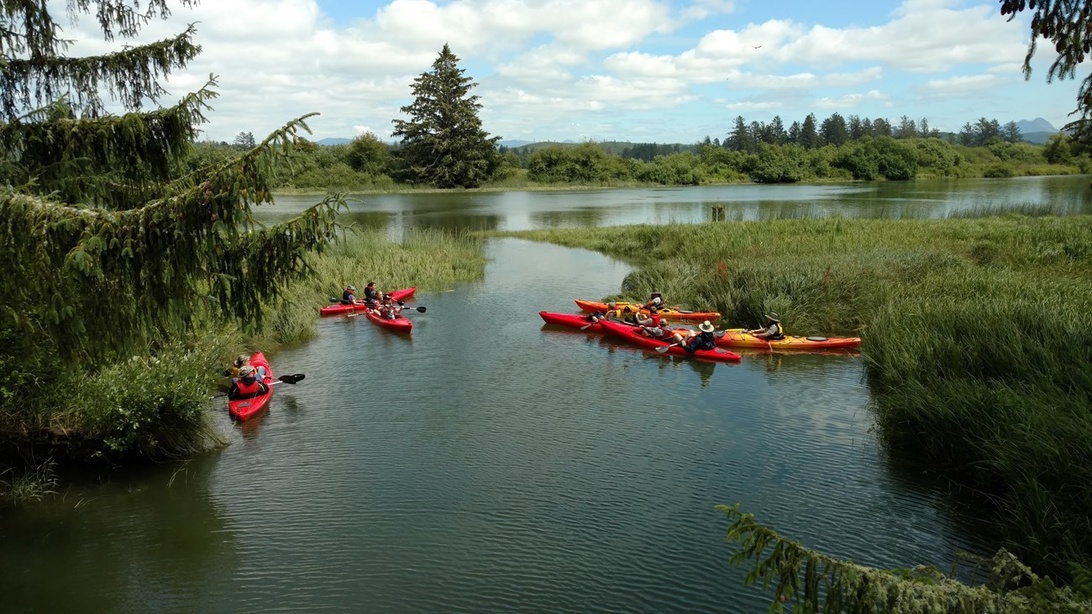
Using a navigation app like Gaia GPS is invaluable for exploring complex coastlines and waterways with offline maps.
Weather and Safety as Top Priorities
The weather is the single most unpredictable factor on the water and can change with frightening speed. A general forecast is rarely enough. This is where specialized apps like Windy and MyRadar come in. Windy provides detailed forecasts for wind speed, direction, and wave height, data that is absolutely crucial for sailors, kayakers, and small boat owners. The basic version is free and incredibly powerful, but a premium subscription offers more detailed forecast models, which can be critical for offshore trips. I make it a habit to always consult Windy before I even start loading my gear. MyRadar, with its real-time radar images, is my tool for keeping an eye on the sky during the trip itself. Being able to see an approaching storm gives me the time I need to seek shelter. However, safety planning does not stop with the weather. Having the official First Aid app from the American Red Cross installed is a must, as it provides clear, step-by-step instructions for emergencies. To ensure someone always knows where I am, especially when I’m out alone, using a location-sharing app like Life360 to keep trusted contacts informed of my whereabouts has become a standard part of my checklist. It provides extra peace of mind for everyone.
Specialized weather apps provide critical data on wind and wave conditions, which is essential for safety on the water.
Specialized Tools for Specific Interests
Beyond general navigation and safety apps, there is a growing ecosystem of platforms tailored for specific water activities. For the fishing enthusiast, FishBrain is an excellent example. It is more than just a digital logbook for your catches; it is a community and knowledge base all in one. By seeing where others have had success and checking updated fishing regulations, you can make more informed decisions. The pro version, with its detailed depth charts and analysis of water conditions, takes fishing strategy to a new level. This trend toward specialized platforms is also seen in larger, organized contexts. Imagine a kayak club or a company that organizes guided tours. Coordinating logistics, sharing routes, and communicating safety protocols with many participants can be a challenge. For these situations, many organizations find that leveraging an advanced digital hub like Omnia with its powerful collaborative tools is the perfect solution for their entire operation. It demonstrates how technology not only helps the individual but also strengthens the community and organization around our water adventures.
Blending Technology with Common Sense and Seamanship
Despite all these fantastic digital aids, it is crucial to remember that they are just that: aids. No app can replace experience, good judgment, or the ability to read the water and weather with your own senses. Technology can warn you of an approaching storm, but it cannot make the decision to turn back in time for you. It can show you the shortest route across a bay, but it does not feel the treacherous currents beneath the surface that only years of experience can teach you to recognize. The best and safest adventures come from a symbiosis between modern technology and traditional seamanship. Use these tools to plan and prepare, to gain a deeper understanding of the conditions, and to have an extra safety line. But once you are out there, trust your intuition and your knowledge as much as you trust the screen in your hand. It is in that balance that true confidence and enjoyment on the water are born.